Shinkula Pass (also called Shinku La or Shinkula Top) is a high-altitude mountain pass at 5,091 metres (16,703 feet) above sea level on the border between Lahaul in Himachal Pradesh and the Zanskar region of Ladakh. It sits on the Nimmu-Padum-Darcha (NPD) road - the newest and most dramatic of India's three highway routes into Ladakh. The name Shinku translates to red in the local dialect, referring to the distinct reddish hue of the rocks and soil near the summit. Higher than Rohtang Pass and Baralacha La, yet far less crowded than either, Shinkula has rapidly become one of the most sought-after high-altitude road trip destinations in the Indian Himalayas.
For decades, Ladakh was accessible only via two routes - the Srinagar-Zojila-Leh highway and the Manali-Leh highway via Baralacha La. Both were congested, heavily used by the military and closed for months due to snow. Shinkula Pass opened a third gateway to Ladakh via Darcha in Lahaul, cutting the distance from Manali to Padum (Zanskar) by nearly 180 km and bringing Himachal and Ladakh closer by approximately 600 km compared to the older routes. The BRO constructed the motorable road from Darcha to Shinkula Pass in 2015 and a regular HRTC minibus service from Himachal to Padum via this route has since been operational. This has transformed access to the previously isolated Zanskar Valley and its ancient monasteries.
The route from Manali to Shinkula Pass passes through some of the most spectacular landscapes in the Himalayas. The journey takes 6 to 7 hours one way. Start early from Manali - ideally by 5:00 to 6:00 AM - to reach the pass in daylight and return safely before dark.
| Stop | Distance from Manali | Altitude | Key Feature |
|---|---|---|---|
| Manali | Start | 2,050 m | Base - fill fuel and carry food |
| Atal Tunnel (South Portal) | 25 km | 3,060 m | 9.02 km tunnel bypassing Rohtang |
| Sissu (Khwaling) | 35 km | 3,120 m | Sissu Waterfall - first view of Lahaul |
| Keylong | 115 km | 3,080 m | Last town - fuel, food, Kardang Monastery |
| Jispa | 125 km | 3,200 m | Beautiful village on Bhaga river - overnight stop option |
| Darcha | 145 km | 3,360 m | Last settlement - BRO checkpost - road becomes rough |
| Ramjak | 155 km | 4,200 m | Off-road begins in earnest |
| Shinkula Pass (Summit) | ~170 km | 5,091 m | Prayer flags, Sinkula Lake 20m below summit |
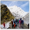
The ascent from Darcha to the summit is the most dramatic section of the journey. The road becomes increasingly rough and unpaved with sharp turns, river crossings and steep rocky sections. A 4x4 SUV is strongly recommended - experienced bikers on Royal Enfield Himalayan or similar adventure bikes also make this journey regularly. At the summit you are greeted by colourful prayer flags fluttering in the wind and a panorama of glacial peaks and valleys that stretches into both Himachal and Ladakh. Sinkula Lake - a shallow pool about 20 metres below the summit on the southern side - is one of the unique features of this pass. The name Sumdo Shinkula North on the northern descent marks the confluence of two glaciers. On clear days the view of Gonbo Rangjon (also called Gumbok Rangan) - a sacred monolithic peak known as the God's Mountain by local Tibetan Buddhist communities - is visible from the descent into Zanskar.
The Shinkula Tunnel (also called Shingo La Tunnel) is an under-construction 4.1 km twin-tube tunnel on the NPD road being built by BRO under Project Yojak. Its south portal is at Darcha in Himachal Pradesh and north portal at Lakhang in Zanskar (Ladakh). When complete it will be the world's longest and highest highway tunnel at an altitude of approximately 4,900 metres.
The foundation stone was laid by Prime Minister Narendra Modi in July 2024 and round-the-clock excavation using tunnel boring machines commenced from both portals. The tunnel will have 2 unidirectional tubes each with 2 lanes (4 lanes total) and longitudinal ventilation. Estimated completion: August 2028. Once open it will provide all-weather access to 15 remote villages of Zanskar Valley currently cut off in winter, reduce the Manali-Kargil distance by 60 km, and provide year-round strategic access to the India-China border for defence forces.
| Month | Road Condition | Recommended |
|---|---|---|
| January - April | Closed - heavy snow | Not possible |
| May (late) | BRO opens - snow clearance ongoing | Only experienced adventure travellers |
| June - September | Open - best conditions | Best time - roads clear, views excellent |
| October | Closing - first autumn snow likely | Possible but check BRO status before going |
| November onwards | Closed - snowbound | Not possible |
Start from Manali by 5:00 - 6:00 AM. The pass takes 8-10 hours from Manali. Starting late risks driving on rough mountain roads after dark on the return. Weather at the summit can change rapidly.
If you want a more relaxed experience rather than a single-day round trip from Manali, consider staying overnight at Jispa (3,200 metres) - widely considered the most beautiful village in the Lahaul Valley on the banks of the Bhaga river. Jispa has camps and guesthouses. Staying here allows you to reach Darcha and the pass in the morning with fresh legs and good light. If you plan to continue into Zanskar, Jispa is the standard overnight stop before the pass.
Once you cross Shinkula Pass the descent takes you into the remote Zanskar Valley of Ladakh. The first village on the Zanskar side is Kargyak - the last village towards the Himachal border, located at 13,000 feet and home to traditional Zanskar way of life. Continuing north you reach Padum - the administrative centre of Zanskar. The famous Phugtal Monastery (Phuktal Gompa) - one of the most remote monasteries in India, built into a cliff face - is accessible from this route. Homestays are available in Padum with limited facilities. A Zanskari meal in Padum is recommended as a cultural experience.

Follow our travel monitoring journeys across India:
Tweet
Visitor Comments
No comments yet. Be the first to share your experience.
Post Your Experience