Mysore to Kodaikanal road trip
Kodaikanal is one of the important Hill station in Southern India. Though Kodaikanal is not the preferred place to visit from Mysore, 2-3 days tour plan can be made to cover surrounding places and return to Mysore which then become the center place. Here is the details about the journey from Mysore to Kodaikanal.
Myosre to Kodaikana is 340 KM , It is 9 hours journey
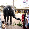
Start early - plan to leave Mysore by 5.30am. The total journey is about 340Kms. There are two ghat areas which may become unexpected for traffic. One more obstacle could be wild animals (elephants) in forest areas. Also, breakfast and lunch are to be planned before reaching Kodaikanal.
Consider the route via T N Pura (Tiruma Kudalu Narsipura) instead of Nanjangud to reach Chamarajnagar as the traffic is less in this route. If you leave Mysore at 5.30am, after 23Kms you will be crossing the place Gargeswari. Take right bypass and at 27Kms there is a bridge on river Kabini. Immediately after crossing the bridge you will reach T N Pura at 6.00am. Take left before entering T N Pura towards Chamarajanagar. At 6.05am, covering 38Kms you will be crossing Mugur. Next, you will be reaching a junction at Santemaralli (48Kms), proceed straight towards Chamarajnagar. At 53Kms,6.12am you will be crossing Goshala where Karnataka government has organized free care taking for cattles. At 6.30am, covering 63Kms, you will be reaching Chamarajnagar.
Don't plan breakfast here. Proceed straight after chamarajnagar bus stand (to the left). There are two dams within 3Kms at 75Kms and 78Kms. First one is called Chikka Hole Dam (right side) and the second one is Suvarnavathi Dam (left side). Don't plan to stop here. Soon after the second dam, forest area starts. Travelling 94Kms (7.00am) you will reach the check post and Karnataka - Tamilnadu border (place name is called Punajanur) is exactly at 100Kms. At Asanur (105Kms) there are resorts to stay. Though tea and tiffin is available, you can wait for a better place. This area is declared as Lepord zone and travelling by Two wheeler is banned between 5.00pm to 7.00am. There is a junction point here where people travelling from Kollegal meet.
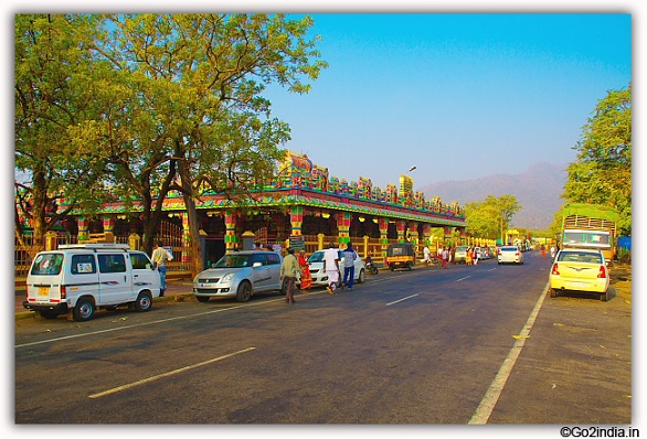
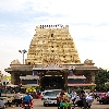
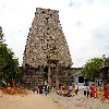
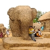
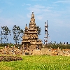
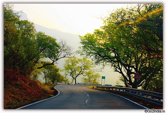
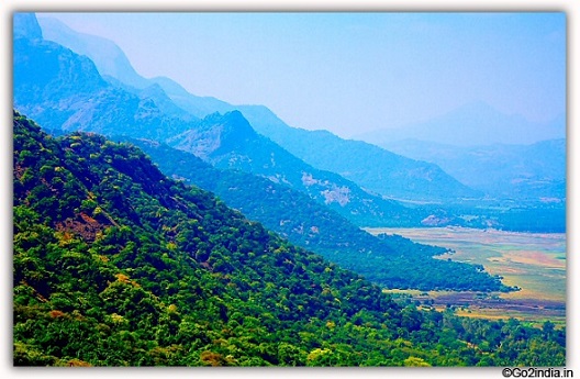
The first Ghat called Sathi Ghat (also called Dhimbham Ghat) starts exactly at 112Kms (7.12am) from Mysore. This Ghat road has 27 hair pin bends. Out of 27 hair pin bends, 20th is very dangerous whereas 7th and 9th are very sharp. Be very cautious while driving (descending) and be attentive of vehicles climbing the ghat. Smaller vehicles are easier to drive. After covering 123Kms, the ghat ends and you will reach one of the famous temple in Tamilnadu, Bannari Amman Temple. Take darshan and people can spend 30mns if the area is not crowded.
Proceed via the road beside the temple to the right (not towards Sathyamangalam). You will be crossing Bhavani sagar dam and a bridge on river Bhavani. At 142 Kms there is a junction, proceed straight towards Puliampatti. At Puliampatti (152Kms 8.55am) take left turn and proceed towards Avinashi. At 9.30am (175Kms) you will reach Avinashi. Consider taking breakfast here as there are good restaurants especially people who like southern Indian food. People require 30 to 45minutes to have their breakfast.
Proceed towards Palladam, take the help of Google map (GPS). You may face language problem if you don't know Tamil as all the boards are in Tamil. You will reach Palladam after crossing Vanjipalayam railway cross. you will reach Palladam at 10.35am (198Kms). After Palladam, drive towards Palani. At Pollachi junction (road from Ooty) take left. While driving in this area, you will see huge number of wind turbines both the sides. You will be passing through Kethanur (10.45am 208Kms), Jallipatti (10.50am, 216Kms), Periyapatti (11.00am, 226Kms), Gudimangalam (11.04am, 234Kms), take left turn at Kottamangalam (11.11am, 237Kms). Go straight at Thungavi junction (11.20am, 245Kms). Take left turn at Madathukulam (11.30am, 253Kms). At 12.00noon 276Kms you will be reaching Palani bypass. Take right turn here to travel towards Kodaikanal. You will find big board indicating distances to various places here.
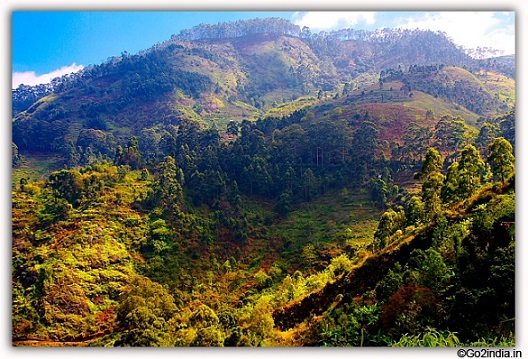
Give rest for 10-15 minutes at this point. Very good tender coconuts are available here. At 288Kms (12.30pm) there is a checkpost and soon after the second forest ghat starts. You will be passing through Savarikkadu (13.11, 311Kms) and there are very deep valleys, drive slowly. Enjoy the scenary of green deep valley for the entire journey. The road is wide enough and not that steep bends are normal. You will be passing Melpallam (13.15, 314Kms), Perumalmalai (13.53, 328Kms) and reach the entry fee collection point (INR 50 for car). At 332Kms (14.10) you will come to Silver Cascade Water falls. Local eatables (sweet corn, mango, bread amlet etc...) with tea are available here. This is a small area, find parking on the road only so that for further journey you will not face problem.
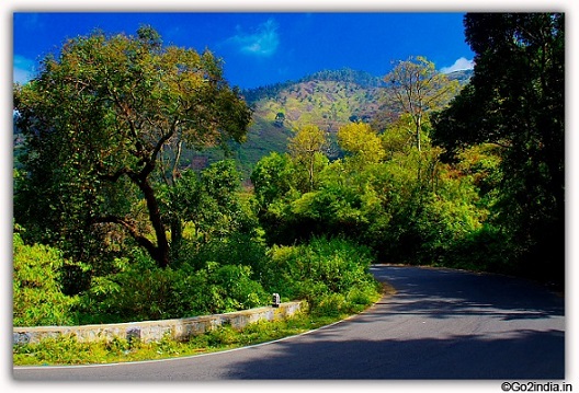
Another 4-5 Kms, you will reach Kodaikanal city (14.45). Most of the restaurants are good, find a better one for Lunch. After lunch, proceed towards Lake area to spend time. Book a lodge for the stay well before the night for a comfortable stay.
This article is written by go2india.in team.
Be the first to post comment on this article :

Tweet